Name the volcano that geologists consider the most dangerous in the Northwest.
No, it's not Mount St. Helens even though an eruption there killed 57 people in our lifetime. The answer is Mount Rainier, chiefly because of the hazard posed by volcanic mudflows, also known as "lahars."
"In terms of stakes, Mount Rainier wins hands down," says John Ewert, the scientist-in-charge at the USGS Cascades Volcano Observatory. He notes over 100,000 people now live on historic lahar deposits in the Puyallup and Carbon River valleys below Mount Rainier.
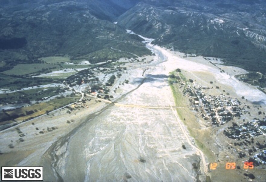
The setting of Mount Rainier reminds Colombian geologist Marta Calvache of home. In front of a full house at Puyallup City Hall, the deputy director of the Geological Survey Colombia described how recent eruptions of snow-capped volcanoes in her country unleashed torrents of mud and debris.
The worst instance in her career killed 23,000 people. That happened in 1985 when lahars swept down from the erupting Nevado del Ruiz volcano.
"We hope you don't have to go through this same experience. Learn about our very bad experience. It doesn’t have to happen," Calvache said.
Last month, emergency managers from Western Washington visited Colombia to see a lahar warning system installed there. In our region, lahar detection sensors and downstream warning sirens are installed to the northwest of Mount Rainier and along the Toutle River near Mount St. Helens.
Calvache says the Colombian experience demonstrates that lahars are eminently survivable if residents heed the warning when the sirens sound and briskly move to higher ground.
Pierce County, Washington has published maps of suggested escape routes and posted blue "volcano evacuation" route signs in vulnerable communities such as Puyallup, Sumner and Orting.
The catastrophic eruption of Mount St. Helens in 1980 unleashed a lahar that raced down the North Fork Toutle River. Mud deposits reached nearly to the eaves of some riverfront homes.
Ewert says a multi-year eruptive episode at Mount Hood in the late 18th century sent lahars down the Sandy River "all the way to the Columbia River."
On the Web:
Monitoring Lahars at Mount Rainier - USGS
Cascades Volcano Observatory - Volcano Hazards Program


